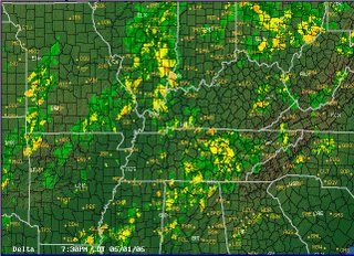
 The summer season is really starting to roll down here. Temps have been in the low 90s, and both warm and cold fronts have made the air very unstable. An approaching cold front had the weather guessers calling for thunderstorms this afternoon, so I thought for sure I would be hanger flying. Fortunately the weather never developed as predicted, and while the radar looked kind of ugly, the air was actually pretty nice. Definitely nice enough to go flying. Now that the weather has turned warmer I'll have to change my routine and either fly before the build ups or after the dissipation. I prefer later.
The objectives of this flight: some T&G's at a different airport.
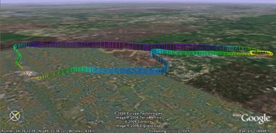
I got out to the airport about 5:30, picked up the dispatch kit and went out to the airplane. To my surprise the Garmin 430 was finally installed! Toys! I decided to stick with my plan and fly up to Cherokee County (47A), but would enter the pattern via a GPS RWY 4 approach. Normal startup and ground procedures. Winds were from the east so I had a RWY 9 departure, turned north and immediately got set up for the approach. Pretty much a standard "T" GPS approach, made interesting by the step downs on the final course. It leaves you at 650 feet AGL at two miles to touchdown. Full flaps and a healthy slip got me there, but it was an effort to get down.
Three bounces and I departed for home. Since my path took me right over the lake, I decided to do some slow work including a power off stall. I like this airplane. Normal entry for a straight in back home resulted in a nice landing. I flew 95.8 miles, reached 151 mph and climbed to 5015 ft.
 AA5B
AA5BTime = 1.1


No comments:
Post a Comment