No, I haven't given up Blogging, or flying for that matter. I had scheduled this flight for two weeks, but cancelled for weather both times. (Last week I actually got the preflight done, only to put the tie down ropes back on when I observed lightning in all quadrants. I got back to the office just before the rains hit. On a related but separate topic, my computer took a hit. The only one that could run the G1000 software got toasted. (Creating this image took about 3x as long due to lack of processor power.)
Today the weather was good. Summertime convection and high humidity had built some cells in the local area, but no lightning and only occasional rain meant we could go.
Objectives of this Flight: Introduction and orientation to the G1000 system.
I like technology and this was just too cool to pass up. Plus, in all my time in the sky I have never flown a new airplane. Yes, it is a little pricey but the 'geek' factor is way high. In addition to the glass cockpit, the additional functions and acronyms (AHRS , ADC, TIS, Mode S transponder, Weather datalink receiver, Automatic Flight Control System) are truly wonderful. I had to give it a try.
I actually started with a written test required by the club for all who wanted to venture into this 21st century aircraft. It forced me into the various flight guides, Pilots Operating Handbook (POH), and even FAR/AIM for a few of the questions. I mentioned that I had the simulator running at home until the computer got fried, and still plan to spend some time at school running that.
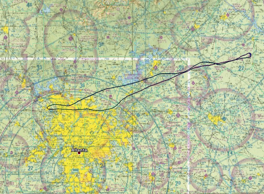
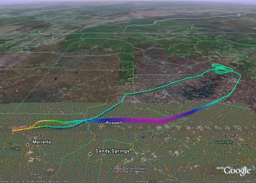
I got to the airport about 7:00(L) just as my CFI was returning from another flight. I got the dispatch kit and went out to preflight. Since this is a new model, I went strickly by the book (13 fuel drains?!?!). I notice that some things I typically check (flaps & lights) weren't on the list. The CFI briefed me on his plan, which was essentially to implement the enroute automation features available. He stressed the use of the autopilot and what interfaces were and were NOT there. We would use the typical training route: RYY, RMG, 47A, to RYY.
Sitting in a new plane is great. All the plastic works, everything is still clean. It is oh, so much better then a new car. Startup is different with a fuel injected engine. Interesting that the very important "advance mixture to full rich" is on the next page. (More POH study for me!) After the brake check he took the plane so I could play. I entered the flight plan, experimented with setting up frequencies, and validated what I had learned about the Audio panel, etc. Runup was normal with no 'new' or unexpected items.
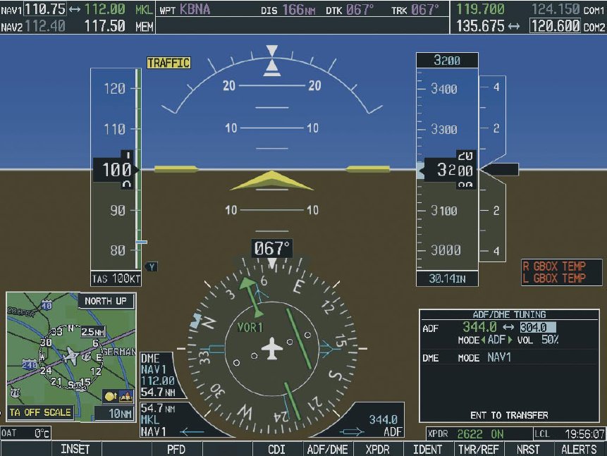 Take off was smooth, the biggest change being to arm the autopilot at about 200ft. Set for best rate of climb, all I had to do was sit back and monitor. And what a LOT to monitor! I was initially overwhelmed. There was simply too much data to comprehend. The huge attitude gyro is great, but where is the RPM, what are the vectors on the MFD, where are my nav and com frequencies? I was looking at the right stuff, but wasn't comprehending what I saw.
Aviate, Navigate, Communicate - back to basics. Fly the airplane first, and the flight instruments make that easy. Ah, the engine instruments are over there on the MFD (co-pilot side) and its pretty easy to see if they are 'green'. Am I enroute to Rome? Yes, the purple line is still there, and the CDI works just like before, just prettier. OK, leveling off at 4500ft and all I have to do is adjust power. Pretty easy. All right, we're leaving RYY airspace, time to tune in Cartersville CTAF. Nearest/airport, select frequency just like the GNS430. I can do this. OK, lets switch from GPS direct to KRMG to the Rome VOR. Select the new source to the CDI, bingo bango off we go. Slick. Go back to GPS, no problem.
 what's going on over on his display? All the engine stuff is there, but he has some additional cool stuff. This is the first time I used Traffic Information System (TIS) and liked it. NEXRAD showed where the clouds were and it also has the Terrain functions. I'm falling in love. Note: this could be a very difficult plane to fly in VFR conditions. There are just too many cool colorful things to look at inside the cockpit.
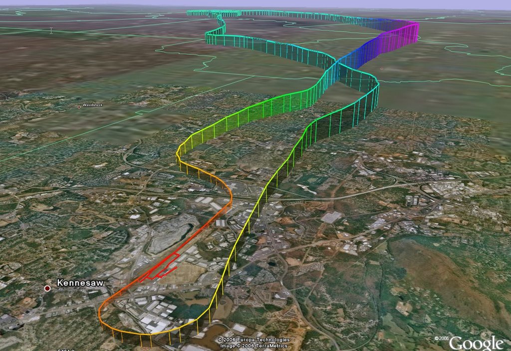
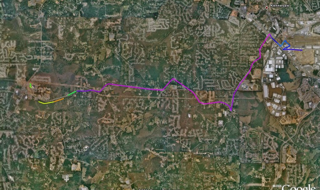
Enroute to Cherokee County we let the autopilot takes us down to 3500, played with "lean Assist" function and discussed emergencies. Then we made the turn, and contacted ATC for the ILS27. "Radar contact. Come left to 180...'. I turned the heading bug and she obeyed. In the digital world, 179 is not close enough as the panel gives you a precise readout. Although NOTAM'd out, since VFR, we went ahead with a coupled approach. WOW. All I had to do was set the correct power for my approach speed and this 'high wing wonder' did the rest...on path, on glideslope. I took it at about 200ft (set up perfectly) for a nice landing. Simply awesome.
C172s - G1000
Time = 1.2