The weather had been unstable. Driving back from Georgia Tech the previous night I encountered pea sized hail and gusty winds. The slow moving cold front was still in the area stirring things up, and during my short drive to the airport I saw a 'big ugly' to the south. Once at KRYY all sectors but south looked OK, and the radar confirmed that going north should be acceptable.
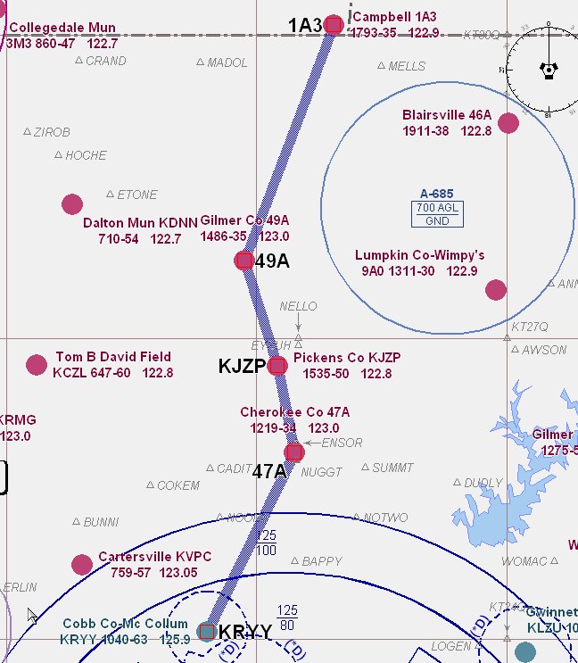
My plan was to fly up to Campbell, TN(1A3). Just on the other side of the state border and the north Georgia mountains. My planner said it would be about 60 miles and take about 40 mins to get there.
Objective of the flight: Practice pilotage. I decided to 'hop" from one airport to the next, while keeping a close eye on the weather.
I had a slot from 6:00 to 8:00 local, but when I got to the airport the Tiger was out. Not a big deal since I was very flexible with my plan. I was surprised though, because until recently I had been one of the very few flying it. I just thought I would have it to myself until the new avionics were installed. (The shop got all the equipment, but there is some issue coupling the autopilot to the GPS. Maybe next week. The good news; a new DG was installed!)
All ground procedures were normal. Smooth takeoff and as I turned to the north I noticed some little puffy ones at about 5000ft. I leveled at 3500ft and headed toward Cherokee County. The air was smooth and visibility better then 8 miles. My predicted heading was validated with the GPS. So far, so good.
As 47A passed under my left wing I made the turn and climbed to 4500. Winds were calm, visibility still good and I began to see that the cloud deck was going from scattered to broken, and coming down. As I passed Pickens County I had a decision to make. The highest peak on my route looked to be 4262, and the quad height was listed at 4400 ft. The layer was still broken, so I could probably sneak through and get above it. But why? When out for a joy ride, discretion is the better part of valor. Time to go home.
I put 49A under my left wing, made the turn, descended to 3500 and headed for home. About 25 miles out I dialed up approach and asked for vectors to the ILS. Misty haze made westward visibility a problem, but I picked up the PAPI just inside AKONE (about 5 miles). I set the power just below the yellow arc, sat back and enjoyed the view. Zero wind. Flaps down, I ballooned a bit (need to work on that, maybe more nose down trim), but made a 'squeaker'.
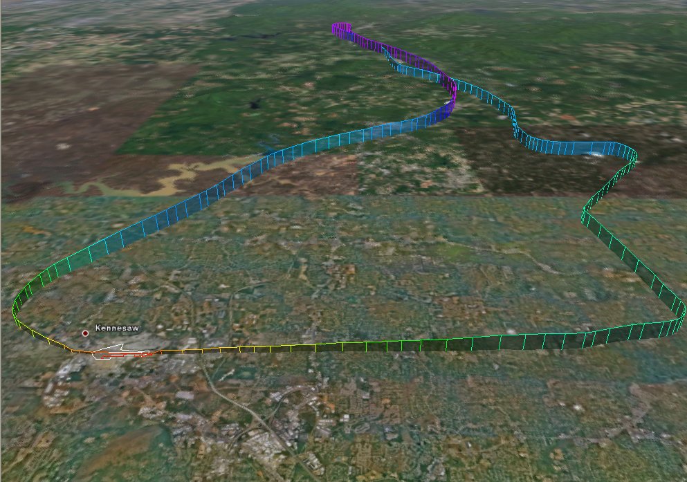
A very nice flight. 5026 ft, max ground speed of 163 mph and a total of 114 miles.
AA5B
Time = 1.2
* Colorized track by goFlying.


No comments:
Post a Comment