 Spring has come to Georgia. While cold fronts still push their way across Alabama, most of them move north before getting to Atlanta. We've had some breezy weather (and a few early morning thunderstorms) but most days have been good for flying. 10 miles in light haze, better then 5500 scattered and just a slight southerly crosswind meant I could make my 4:00pm reservation.
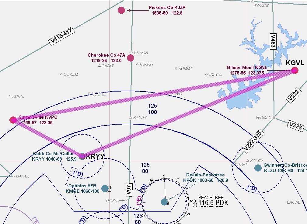
Objectives of the flight: 1) solo the Tiger, 2) play with the navigation (without the Garmin 430), and 3) see how she handles on an ILS. My plan was to fly over to Cartersville (VPC), then to Gainsville (GVL) and the ILS back home.
I took my time with the preflight, and carefully reviewed the checklist after my walk around. I still have that "new" feeling, and wanted to make sure I hadn't missed anything. Startup and taxi were all normal (nice to have the canopy open for the trip to the runup area). Once use to the differential braking, the ground control on this plane is great. Runup complete, I was tempted to leave the canopy open for take off, but didn't. Climb out enroute to VPC goes fine, and the visibility is superb.
 Rather then just enter the pattern, I decide to do the Loc 19 just to see how the needle lines up. Call traffic and find three in the pattern, one is entering on the VOR A that goes too close to the power plant cooling towers, and another is inbound at the FAF for the same approach I'll be doing. I can see the guys in the pattern, I'll keep looking for the other two. By procedural turn inbound, all heads are accounted for and the LOC needle is right on. A Seminole is on downwind and I do a 360 to take interval on him (I got what I needed out of the approach). My two landings are a bit fast, but OK. Depart Cartersville and head east.
Gainsville is about 60 miles to the east, so I have a little time to play navigator. ENSOR intersection is about half way there, so I head for it. I have One VOR, and no GPS, so this should be interesting. My basic airwork suffers (but not too bad) as I twist radio frequencies and the OBS knob. You know, this stuff still works. Once I've convinced myself that I can do it, I go back to the 'easy way' and pull out my handheld GPS. (Nearest function, find GVL, direct/enter/enter and the purple line shows the way.)
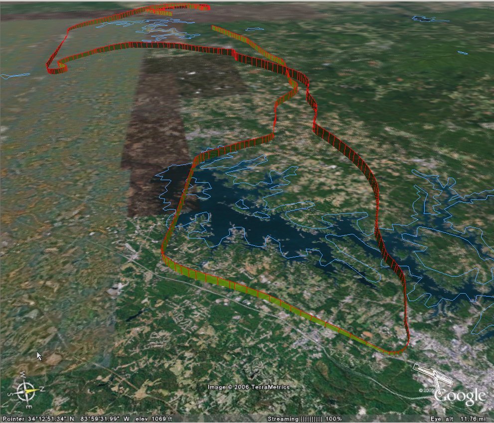
GVL is located on the eastern edge of Lake Lanier, a beautiful reservoir and one of the main boating spots for Atlanta. It looked like everyone was out on the water. One other plane was shooting the Loc Rwy 4 so I gave myself vectors and followed him down for a low approach. Missed at mins and headed west.
 After climbing to 4500 ft, I got my only Comm Radio tuned to ATIS, then switched it over to Approach, listened for a bit, and found they were not too busy. 'AMICEATM' complete, I called for vectors, was given a squawk and a heading to fly. And another heading to fly. And another heading to fly. Finally the controller asked me what heading I was on and when I confirmed he cautioned me that I was still too close to the final approach course. BING! The first 'M' in AMICEATM stands for Marker Beacons on AND Magnetic compass (align Gyro.) I had done this correctly going into Gilmer, but not for McCollum. It was about 30 degrees off. (Ouch). OK, so how many time will I do that again? (Note the squirrelly blurb just prior to the ILS.) I 'fessed up' and the rest of the approach was normal.
Very nice landing at home. Except for a minor seat problem (adjustment lever came off in my hand when I tried to push my seat back to get out) normal shutdown and clean up. After tying her down, a beautiful old Twin Beech came down the taxi way. No paint, just polished aluminum and just wow. I traveled 190 miles, a max speed of 165 mph(!) and got up to 4735 feet.
AA5B
Time = 1.9


No comments:
Post a Comment