The objectives of the flight: 1) Practice Pilot for an Instrument Pilot, 2) Practice a non-precision approach, 3) go some place different.
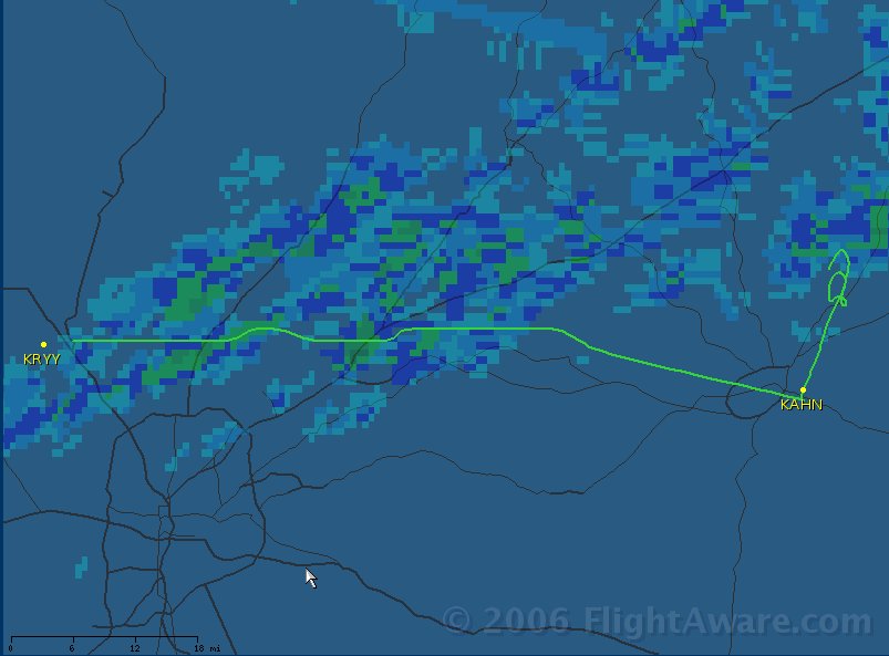
The weather has been somewhat unstable. Ceilings and visibility are OK, but temperatures have been warm and winds gusty. Our original plan was to go west to KPLR, but after reviewing the METARS, Airmets and Pireps we decided to go east and avoid some turbulence. A series of low pressure areas and a polar cold front was slowly moving just northwest of us stirring things up.
Athens (home of UGA) is about 75 miles from McCollum so would work for his x-country time. We also planned to come back to Winder (KWDR - Spitfire Grill) switch seats, go up to Gilmer (KGVL - Lake Lanier) and finally home. This would roughly split the time and if running late, I still have my night currency.
The oil was a bit low so preflight took longer then expected. Groundwork was all normal and we took off about 4:30. Fairly good winds out of the south, but only a little turbulence. He but the foggles on and headed roughly east climbing to 5,500. Visibility was good, about 8 miles in haze. Interesting for me as we flew by a number of out lying airports a portion of metropolis Atlanta. We listened to various common traffic frequencies, tuned radios and in general practiced x-country procedures.
We immediately noticed that the GPS was setup for 'Track Up". Both of us prefer "North Up". It took me a minute to remember that this correction is found by pressing the Menu button, using the Map Options to change the settings.
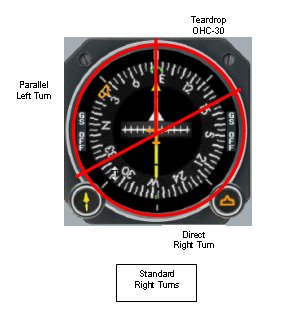
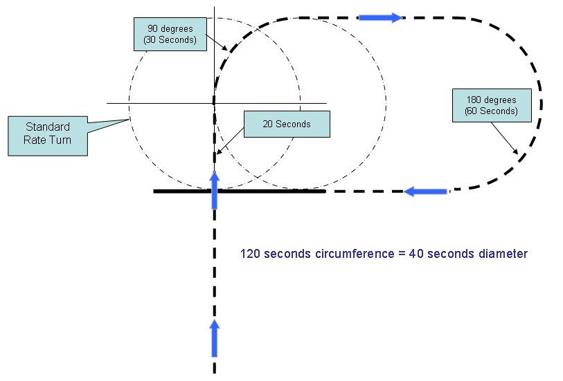
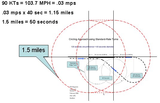
The next task was to enter holding for the RNAV20 approach. I was taught to divide the directional gyro into three quadrants. For a standard pattern (right turns), 70 degrees to the right for a teardrop entry, 110 degrees to the left for a parallel entry, and the remaining 180 degrees for a direct entry. Find the Outbound Holding Course (OHC) on the DG, see what sector its in
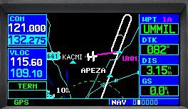 and make the appropriate turn passing the holding fix. (Time, twist, turn, time, transition, talk). However, does GPS change this? You can see the holding pattern on the display, so is it really necessary to pass the holding fix for entry, or can you just turn onto the purple line and continue with the approach?
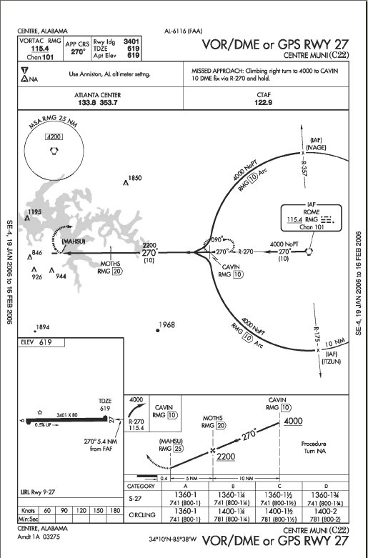
He completed the procedural turn (holding) and headed inbound. Athens is a towered field and there was one other plane in the pattern for Rwy27. However he was well clear by the time we passed the Final Approach Fix (FAF). The PIC started his descent late and never really got down to the MDA, so we executed a low approach, made a left turn for a downwind entry into the traffic pattern. An uneventful full stop landing allowed us to taxi over to the tower to stretch our legs and change seats.
Startup, taxi and runup were all normal. Winds had subsided so my takeoff was smooth and subsequent climb to 4000 was uneventful. However we we running a bit late so decided to forgo Gilmer and just head for home. Upon level off I contacted Atlanta approach and requested vectors to KRYY. They were not too busy, but there was another aircraft with a similar call sign. Very smooth air, but haze obscured our vision looking west and made for a beautiful sunset.
The low voltage light came on, rats. The procedure is to turn off the avionics switch and cycle the master. This plane has a digital voltage gage in addition to the discharge meter, and it showed we would lose 2 tenths of a volt, gain a tenth, etc. Slight discharge was showing. I was about 30 minutes out. hmmmm. Cycled strobes, checked breakers, no help.
Well, I decided to let it be. Monitored closely, but decided it would be OK for now. I did feel better when we called the field in sight. Contacted tower for a straight in, and made a 'squeaker' night landing.
We traveled 208 miles, climbed to 5757ft and reached 154mph over the ground.
C172p
Time = 2.3


